Showing posts with label Himalaya. Show all posts
Showing posts with label Himalaya. Show all posts
Nov 22, 2017
Nov 17, 2017
Picturesque Bridge over the Rungnoo below Ging - Darjeeling 1865

Photograph of a bridge near Ging, taken by Samuel Bourne in the 1860s. Samuel Bourne's photographs display a compositional elegance which appealed to Victorian notions of the ‘picturesque’; strategically framed landscapes of rugged mountain scenery, forests, rivers, lakes and rural dwellings. Bourne chose his routes with care, planning his itineraries based on the latest maps, the locations of renowned geological features, glaciers, high passes, the sources of major rivers, unusual land forms with fossils and places of archaeological note.
Sep 13, 2016
Sep 11, 2016
Postcard of Kangchenjunga - Darjeeling 1907
Kangchenjunga (Nepali:कञ्चनजङ्घा Kanchanjaŋghā), (Limbu Language: Sewalungma (सेवालुन्ग्मा) ), is the third highest mountain in the world (after Mount Everest and K2), with an elevation of 8,586 metres (28,169 ft). Kangchenjunga translated means "The Five Treasures of Snows", as it contains five peaks, four of them over 8,450 metres. The treasures represent the five repositories of God, which are gold, silver, gems, grain, and holy books. Kangchenjunga is called Sewalungma in the local Limbu language, translates as 'Mountain that we offer Greetings to'. Kanchenjunga or Sewalungma is considered sacred in the Kirant religion.(Wikipedia)
Source: ebay.com
May 22, 2016
Landslide in Nainital - September 1880
Nainital before landslide
Nainital after landslide
In September 1880 a landslide (the Landslip of 1880) occurred at the north end of the town, burying 151 people. The first known landslide had occurred in 1866, and in 1879 there was a larger one at the same spot, Alma Hill, but "the great slip occurred in the following year, on Saturday 18 September 1880." "Two days preceding the slip there was heavy rain, ... 20 inches (508 millimetres) to 35 in (889 mm) fell during the 40 hours ending on Saturday morning, and the downpour still lasted and continued for hours after the slip. This heavy fall naturally brought down streams of water from the hill side, some endangering the Victoria Hotel, ... (which) was not the only building threatened ... Bell's shop, the Volunteer Orderly Room and the Hindu (Naina Devi) temple were scenes of labour with a view to diverting streams. At a quarter to two the landslip occurred burying those in and around the buildings mentioned above." The total number of dead and missing were 108 Indian and 43 British nationals. (See poem by Hannah Battersby on the page Literary references to Nainital). The Assembly Rooms and the Naina Devi Temple were both destroyed in the disaster. A recreation area known as 'The Flats' was later built on the site and a new temple was also erected. To prevent further disasters, storm water drains were constructed and building bylaws were made stricter. (wikipedia)
Source: ebay
Jan 5, 2016
Mussucks at the banks of the Beas river in Kullu valley, Himachal Pradesh - 1865
View at the banks of the Beas river in Kullu valley, taken by Samuel Bourne in the 1860s. A mussock is a normally a leather water bag, consisting of the entire skin of a large goat, carried by a ‘bhishti’, a domestic servant who supplied the family with water. But in this photograph these seem to be inflated bullock skins used to cross the water. Bourne's dark-tent is pictured under the tree, as is Dr George Rankin Playfair, a surgeon knowledgeable in natural history and the latest theories of glacial movement, who accompanied Bourne on his third Himalayan trip.
Photographer: Samuel Bourne
Source: British Library
Posted by
Old Indian Photos
at
9:23 PM
Labels:
1860s,
Bourne and Shepherd,
Himachal Pradesh,
Himalaya,
Landscape,
River
Oct 31, 2015
Aug 26, 2015
Aug 23, 2015
Mar 17, 2015
Various Postcards of Mount Everest - 1920's
Eastern Spurs of Mount Everest. The Expedition of 1921 found that there is no hope of ascending Mount Everest by its eastern spurs, which descend by steep ice cliffs into the deep Kama Valley beyond the nearer peak.
The Highest Photograph Ever Takne. The first climb in 1922 without Oxygen reached close to 27,000 feet and from this point Mr. T.H Somervell took the photograph showing the summit of the North Peak, 24,550 feet, well below on the right, and Gyachung Kang,25,990 feet, well below the horizon towards the left.
Mount Everest from the Rongbuk Glacier - The main Rongbuk Clacier leads to the inaccessible northwestern face of the mountain. The route to the summit is by the East Rongbuk Glacier beyond the hills to the left of the picture. The highest point yet reached on the mountain is exactly behind the summit of the North Peak which lies in front of Mount Everest.
The first view of Mount Everest - As the expedition crosses the quicksands at the junction of the Yarn and the Bhong Chu, Mount Everest comes into sight about seventy miles away. The Expedition has still ten days' march before reaching the Base Camp in the Rongbuk Valley
Source: ebay
Feb 23, 2015
Jan 28, 2015
Dec 27, 2014
Dec 20, 2014
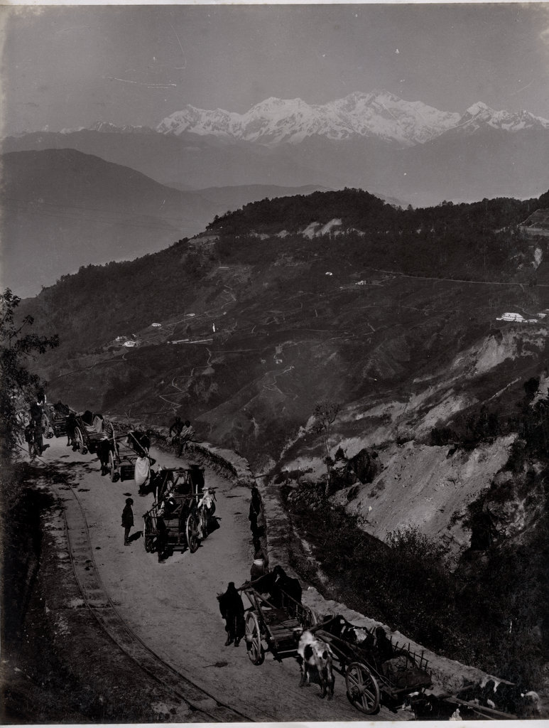
A Train in Upper Paglajhora in Darjeeling - India c1880s
Posted by
Old Indian Photos
at
9:27 PM
Labels:
1880s,
Bengal,
Darjeeling,
Himalaya,
Railways,
Transportation
Nov 27, 2014
Subscribe to:
Posts (Atom)


.JPG)
.jpg)
.JPG)
.jpg)
.JPG)
.jpg)


