


Showing posts with label Architecture. Show all posts
Showing posts with label Architecture. Show all posts
Aug 12, 2021
Aug 8, 2021
British Residency at Hyderabad - c1860's

Photographs from the book: Sketches in India; Taken at Hyderabad and Secunderabad, by Captain Allan N. Scott, Madras Artillery.
Source: British Library
Hindoo Temple Secunderabad - c1860's

Photographs from the book: Sketches in India; Taken at Hyderabad and Secunderabad, by Captain Allan N. Scott, Madras Artillery.
Source: British Library
Tomb of a Mahomedan Lady at Booran Sahib's Durgah, Near Hyderabad - c1860s


Photographs from the book: Sketches in India; Taken at Hyderabad and Secunderabad, by Captain Allan N. Scott, Madras Artillery.
Source: British Library
Entrance to the Tomb of Boorhan Sahib, Near Hyderabad - c1860s

Photographs from the book: Sketches in India; Taken at Hyderabad and Secunderabad, by Captain Allan N. Scott, Madras Artillery.
Source: British Library
Very Ancient Jain Temple at Mucktagberry near Ellichpoor, 280 Miles from Hyderabad - c1860s

Photographs from the book: Sketches in India; Taken at Hyderabad and Secunderabad, by Captain Allan N. Scott, Madras Artillery.
Source: British Library
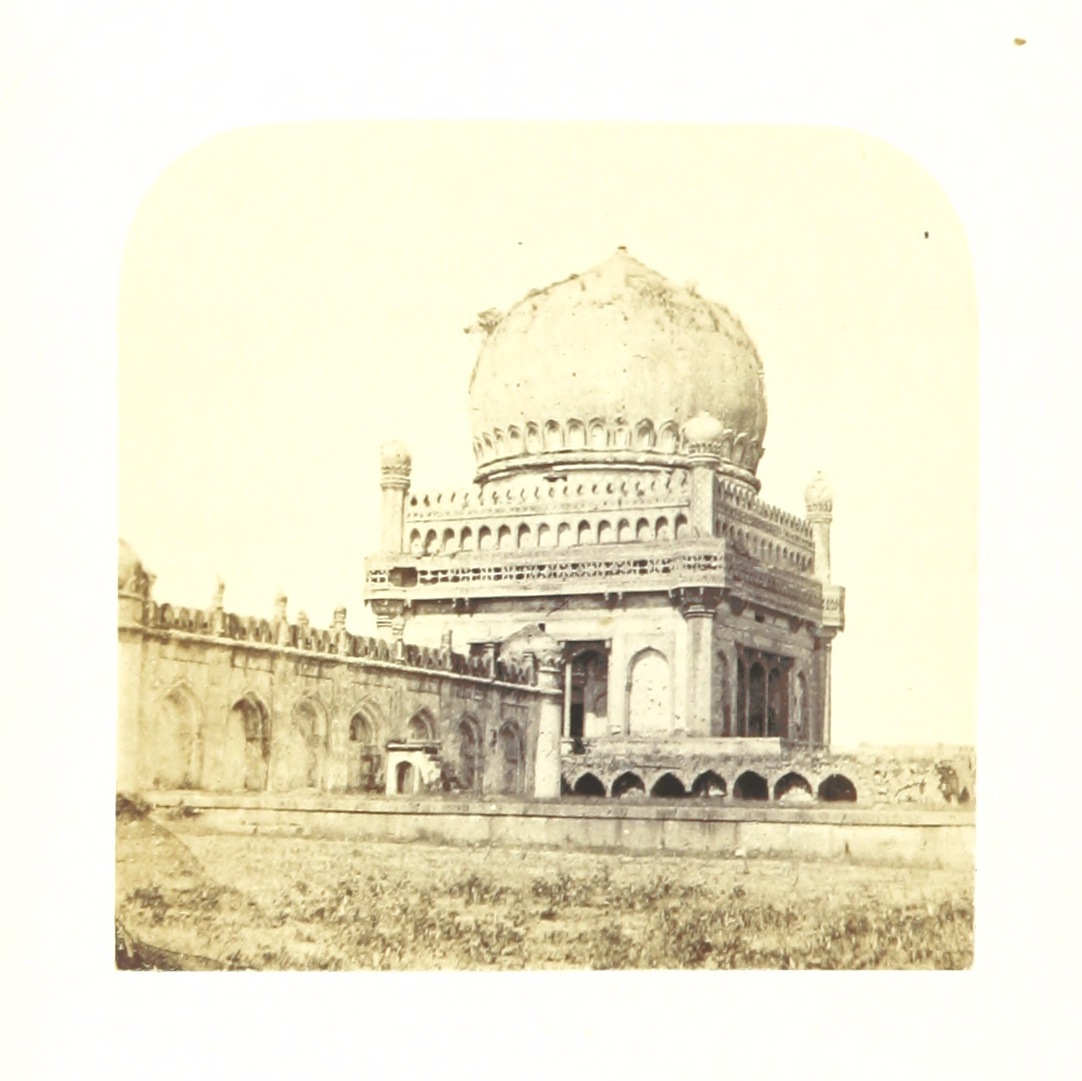
Tombs of the Ancient Kings of Golconda - 1860s
Photographs from the book:
Sketches in India; Taken at Hyderabad and Secunderabad, by Captain Allan N. Scott, Madras Artillery.




Sacrcophagus under the Dome of the Tomb Represented in No.5
Colonnade of the Tom represented in no 9
Source: British Library
Sketches in India; Taken at Hyderabad and Secunderabad, by Captain Allan N. Scott, Madras Artillery.
Sacrcophagus under the Dome of the Tomb Represented in No.5
Colonnade of the Tom represented in no 9
Source: British Library

Aug 7, 2021

Govinda Ram Mittee's Pagoda, Calcutta (Kolkata) - Colour Print, 1798

Medium: etching and aquatint with hand-colouring
Source: British Library
Jul 6, 2020

Jan 3, 2019

Mar 31, 2018

Dec 9, 2017
Various Temples North of The Mamallapuram Village in Tamil Nadu - c.1885
 Small Temples North of the Village of Mamallapuram
 Unfinished Cave Temple, Mamallapuram in Tamil Nadu - c.1885
 Unidentified Cave Temple, Mamallapuram in Tamil Nadu - c.1885
 Unidentified Cave Temple, Mamallapuram in Tamil Nadu - c.1885
 Unidentified Cave Temple, Mamallapuram in Tamil Nadu - c.1885
 General View of the Entrance to the Krishna Mandapa, Mamallapuram in Tamil Nadu - c.1885
 View from the South-West of the Arjuna Ratha and the Draupadi Ratha, Mamallapuram, Tamil Nadu - c.1885
 Two Unfinished Rathas, Mamallapuram, Tamil Nadu - c.1885
 General view from the north-west of the Shore Temple, Mamallapuram, Tamil Nadu - c.1885
 General view from the south-west of the Bhima Ratha, Mamallapuram, Tamil Nadu - c.1885
 General view of the entrance to the Varaha Cave Temple, Mamallapuram, Tamil Nadu - c.1885
 Front view of the Dharmaraja Cave Temple, Mamallapuram, Tamil Nadu - c.1885
 General view from the North-West of the Shore Temple, Mamallapuram, Tamil Nadu - c.1885
 Unidentified Cave Temple, Mamallapuram in Tamil Nadu - c.1885
 Two Unfinished Rathas, Mamallapuram, Tamil Nadu - c.1885
 Olakkanatha Temple, a structural shrine above the Mahishamardini Cave Temple, Mamallapuram, Tamil Nadu - c.1885
 General view of the entrance to the Pancha Pandava Mandapa, Mamallapuram, Tamil Nadu - c.1885
 General view from the south-west of the Dharmaraja Ratha, Mamallapuram, Tamil Nadu - c.1885
 Vahara cave temple, Mamallapuram, Tamil Nadu - c.1885
 General view of the Ganesha Ratha, Mamallapuram, Tamil Nadu - c.1885
Various Photographs of Rock Fort Temple Complex in Tiruchirapalli (Trichy), Tamil Nadu - 19th Century
Tiruchirapalli is situated on the River Kaveri in Tamil Nadu, India. The town has been a stronghold of various ruling dynasties like Pallavas, Cholas, Nayakas and later occupied by the British. The town is dominated by the Rock Fort, a massive sand-coloured rock which towers to a height of over 80 metres. The Pallavas were the first to exploit the rock, building temples into its side, but it was the Nayakas of Madurai who realised the site's potential as a fort adding only a few walls and bastions as fortifications in the 17th century. They firmly established Tiruchirapalli as an important trading city.
The Rock is about 84 m high (273 feet) and its summit, crowned by a modern Ganesha temple (Ucchi Pillaiyar Koil), can be reached by means of 437 steep steps. The Nayakas of Madurai realised its strategic position and built the Rock Fort in the 17th century. The last major battle here was fought during the Anglo-French wars of the Carnatic in the 18th century. Carved into the southern face of the Rock are cave temples dating from the time of the Pallava king Mahendravarman I (reigned 570-630) and the Pandya period (8th century). At the west face is the 17th century Thayumanaswamy temple dedicated to Shiva, where the lingam is a natural rock projection.
Know more about this historic place in Wikipedia.

 Date: 1858
Photographer: Linnaeus Tripe
 Date: 1868
Photographer: Edmund David Lyon
 Date: 1869
Photographer: Samuel Bourne
 Date: 1880
Photographer: Nicholas and Company
Source: British Library
The Rock is about 84 m high (273 feet) and its summit, crowned by a modern Ganesha temple (Ucchi Pillaiyar Koil), can be reached by means of 437 steep steps. The Nayakas of Madurai realised its strategic position and built the Rock Fort in the 17th century. The last major battle here was fought during the Anglo-French wars of the Carnatic in the 18th century. Carved into the southern face of the Rock are cave temples dating from the time of the Pallava king Mahendravarman I (reigned 570-630) and the Pandya period (8th century). At the west face is the 17th century Thayumanaswamy temple dedicated to Shiva, where the lingam is a natural rock projection.
Know more about this historic place in Wikipedia.

Date: 1895
Photographer: Nicholas and Company
Photographer: Linnaeus Tripe

Photographer: Edmund David Lyon

Photographer: Samuel Bourne

Photographer: Nicholas and Company
Subscribe to:
Posts (Atom)